News Blog
North Coast Night Lights: South Fork Bridge, July 2018
- David Wilson
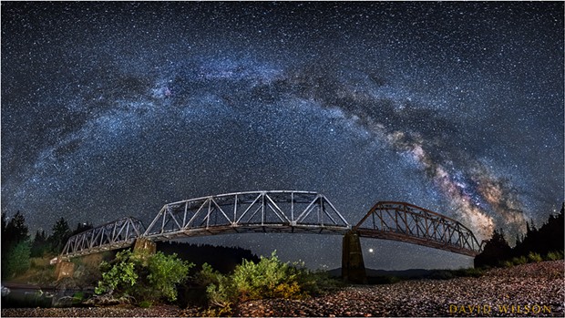
- The Milky Way arcs from horizon to horizon above the South Fork Bridge in this panorama on the Main Fork Eel River, Humboldt County, California. July, 2018.
This summer I went out on two different nights to this bridge with a photo friend of mine, the first night becoming overcast early. Illuminating the bridge was an exercise in painting light with a flashlight, adding touches of light here and there in the dark. Some light also came from street lamps along U.S. Highway 101 across the river far behind us. A combination of those lamps, the light painting, long exposures of around 30 seconds, a high ISO setting (light sensitivity) and a fairly wide aperture combined to make the scenes bright and detailed.
My hope was to make a panoramic image of the bridge with the Milky Way arcing over it. I’d scouted it out in the daylight and I saw that if I came back at night I would find the image I sought. But it’s often overcast along the river late at night, and such proved to be the case the first night. I took a few photographs, but the sky grew progressively cloudier and, though we waited patiently, we were never to get a clearer view of the Milky Way and I didn’t make the panorama.
- David Wilson
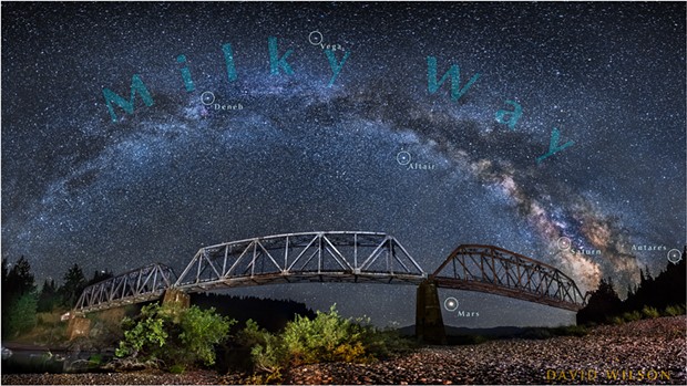
- South Fork Bridge beneath an annotated panorama showing the planets Saturn and Mars, the latter large as it neared its close approach, as well as some of the notable stars along the Milky Way.
I made the panorama by shooting four vertical photographs of the bridge side by side, each of the images overlapping the next. Later I would match them together in the computer to show the entire, wider scene. It was a challenge to illuminate the shots consistently with only a flashlight but it’s necessary in order for the separate images to blend well with each other.
- David Wilson
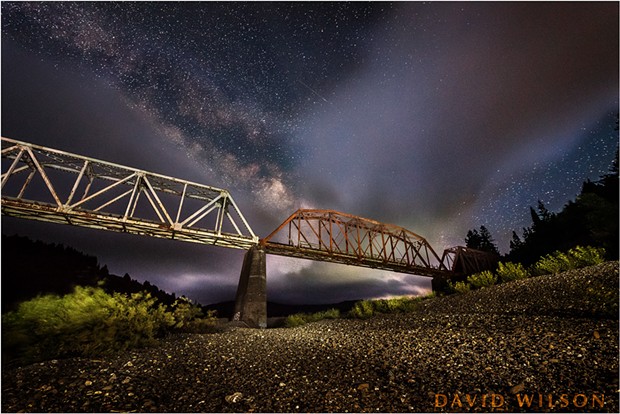
- A variation in lighting on the bridge from the first night out, before the clouds overcame us.
These are the same railroad tracks you see against the bluffs across from Rio Dell and the tracks that run along Eureka’s waterfront, where you can still find some rusty trains sitting on the rails down at Commercial Street and Waterfront Drive; they're the tracks that run along 101 between Eureka and Arcata, and the ones that continue out past Janes Road toward Blue Lake. It’s easy to forget as younger generations grow up without them that not too long ago the trains were running, and one could watch them pass daily and hear their whistles and rumblings.
To keep abreast of David Wilson’s most current photography or peer into its past, follow him on Instagram at @david_wilson_mfx or his website mindscapefx.com, which Wilson says he updates less frequently.

Comments