News Blog

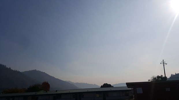
- Courtesy of Wes Crawford
- Smoke from the Signboard Fire rising over Hoopa.
PREVIOUSLY:
An escaped prescribed burn has spread over 30 acres of steep terrain east of Hoopa, according to Peggi Lawrence, Public Affairs specialist for Six Rivers National Forest.
Yesterday afternoon, the Signboard Fire rolled downhill from a planned burn started last Thursday by Hoopa Tribe to manage the forest.
“Burning material has been running downhill. It’s extremely steep,” Lawrence explained. “Some rolled onto Six Rivers Forest land.”
Hoopa Tribe and Six Rivers now have formed a unified command with the Hoopa Tribe,” according to Lawrence. “The southern edge of the fire has 15 percent containment,” she said.
She said that at this time there are two helicopters, two hand crews, three engines, two dozers as well as miscellaneous overhead personnel for a total of 75 people working on the fire.
“[The fire’s] not putting out big flames,” Lawrence said. “It is creeping and smoldering. It is not crowning.”
Read the release from the Six Rivers National Forest below:
HOOPA, Calif. – Hoopa Valley Tribe and Six Rivers National Forest fire management personnel are working in a unified command to contain the Signboard Fire, located near Tish Tang Ridge. The 30-acre wildfire—approximately 15 acres on the Hoopa Valley Reservation and 15 acres on the Six Rivers National Forest—is 15 percent contained.Editor's note: This report first appeared on www.kymkemp.com and is reposted here with permission.
Originally the Tish Tang Prescribed Fire, the Signboard Fire was declared a wildfire on Tuesday, November 13, once the prescribed fire left reservation lands and crept on to National Forest System lands. This low-intensity fire continues to creep and smolder through brush in steep, rugged terrain near Tish Tang Ridge. To minimize risk, firefighters will avoid the steep terrain by constructing indirect firelines on ridges to the east and west of the fire.
Fire priorities are focused on firefighter safety, protecting economic, natural, cultural and heritage resources, and property improvements and infrastructure. Objectives are to keep the fire north of Horse Linto Trailhead, south of Tish Tang, west of Signboard Trailhead 7N09, and north of Horse Linto Creek.
Updates will be provided as additional information becomes available.
Comments