News Blog
Hazardous Weather to Hit Humboldt with Flood, Wind Watches Issued
- National Weather Service
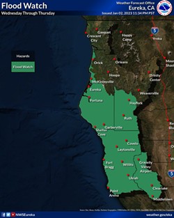
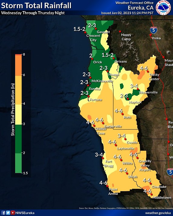
“A major storm system will impact the region Wednesday into Thursday, with damaging wind gusts, heavy rainfall and flooding for parts of the region,” the National Weather Services’ Eureka office tweeted. “Today is the time to prepare. Fuel generators, purchase batteries for flashlights, and bring loose objects in your yards inside.”
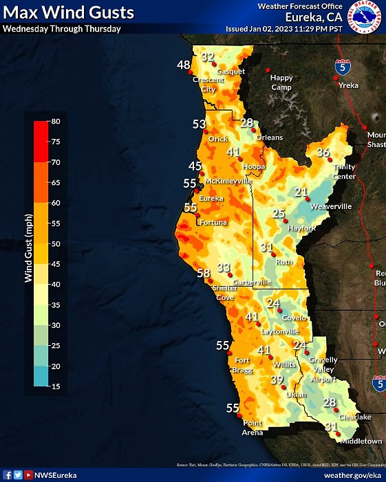
Wind gusts in excess of 70 mph are possible on ridgetops, with gusts of 40 mph and 60 mph possible in valleys and coastal areas, respectively, the weather service warned.
“Winds of this strength when soil conditions are saturated can result in many trees being knocked down and numerous power outages,” the weather service continued. "Driving conditions will be extremely dangerous. Even in valley locations, gusts could exceed 40 mph and in coastal area as high as 60 mph. If you can, adjust your travel plans and don't travel Wednesday or Thursday. Falling trees can be deadly."
- National Weather Service
Rainfall is forecast to begin today around 10 a.m. and continue for most of the day, spurring the flood watch to begin at 1 a.m. tomorrow. The watch will remain in place through Thursday morning, with showers predicted throughout the day tomorrow. The high winds are forecast to pick up tomorrow morning and continue through Thursday morning.
- National Weather Service

Comments